

Meltwater is hydro-fracking Greenland’s ice sheet through millions of hairline cracks – destabilizing its internal structure
- Written by Alun Hubbard, Professor of Glaciology, Arctic Five Chair, University of Tromsø
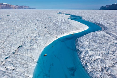 Richard Bates and Alun Hubbard kayak a meltwater stream on Greenland's Petermann Glacier, towing an ice radar that reveals it's riddled with fractures.Nick Cobbing.
I’m striding along the steep bank of a raging white-water torrent, and even though the canyon is only about the width of a highway, the river’s flow is greater than that of...