Human exposure to wildfires has more than doubled in two decades – read this if you're planning fireworks on July 4
- Written by Mojtaba Sadegh, Associate Professor of Civil Engineering, Boise State University

Over the past two decades, a staggering 21.8 million Americans[1] found themselves living within 3 miles (5 kilometers) of a large wildfire. Most of those residents would have had to evacuate, and many would have been exposed to smoke and emotional trauma from the fire.
Nearly 600,000 of them were directly exposed to the fire, with their homes inside the wildfire perimeter.
Those statistics reflect how the number of people directly exposed to wildfires more than doubled from 2000 to 2019, my team’s new research[2] shows.
But while commentators often blame the rising risk on homebuilders pushing deeper into the wildland areas[3], we found that the population growth in these high-risk areas[4] explained only a small part of the increase in the number of people who were exposed to wildfires.
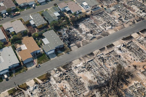
Instead, three-quarters of this trend was driven by intense fires growing out of control and encroaching on existing communities.
Smoke rises from a brush fire near Hollywood Hills in Los Angeles in 2007. Hector Mata/AFP via Getty Images[5]That knowledge has implications for how communities prepare to fight wildfires in the future, how they respond to population growth and whether policy changes such as increasing insurance premiums to reduce losses will be effective. It’s also a reminder of what’s at risk from human activities, such as fireworks on July 4, a day when wildfire ignitions spike[6].
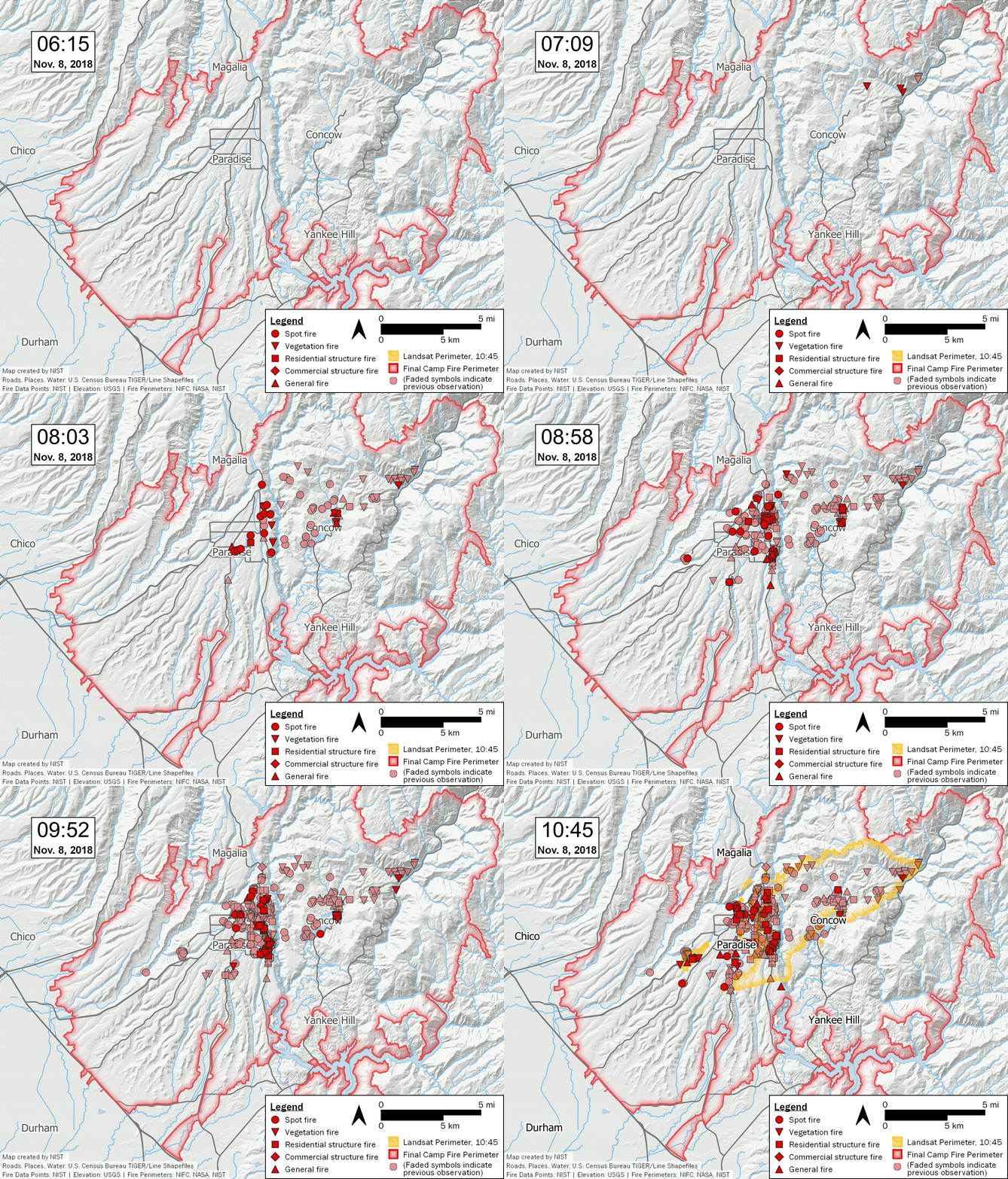
 The 2018 fire that destroyed Paradise, Calif., began as a small vegetation fire that ignited new fires as the wind blew its embers. NISTWildfires in the high mountains[15] in recent decades provide another way to look at the role that rising temperatures play in increasing fire activity.
High mountain forests have few cars, homes and power lines that could spark fires, and humans have historically done little to clear brush there or fight fires that could interfere with natural fire regimes. These regions were long considered too wet and cool to regularly burn. Yet my team’s past research showed fires have been burning there at unprecedented rates in recent years, mainly because of warming and drying trends in the Western U.S.[16][17]
What can communities do to lower the risk?
Wildfire risk isn’t slowing. Studies have shown that even in conservative scenarios[18], the amount of area that burns in Western wildfires is projected to grow in the next few decades.
How much these fires grow and how intense they become depends largely on warming trends. Reducing emissions will help slow warming, but the risk is already high. Communities will have to both adapt to more wildfires and take steps to mitigate their impacts.
Developing community-level wildfire response plans, reducing human ignitions of wildfires and improving zoning and building codes can help prevent fires from becoming destructive. Building wildfire shelters in remote communities and ensuring resources are available to the most vulnerable people are also necessary to lessen the adverse societal impacts of wildfires.
References^ 21.8 million Americans (www.nature.com)^ new research (www.nature.com)^ deeper into the wildland areas (www.opb.org)^ population growth in these high-risk areas (theconversation.com)^ Hector Mata/AFP via Getty Images (www.gettyimages.com)^ July 4, a day when wildfire ignitions spike (doi.org)^ CC BY-ND (creativecommons.org)^ climate scientist (scholar.google.com)^ such as California often sees (wrcc.dri.edu)^ from a power line (www.pbs.org)^ Recent research (doi.org)^ George Rose/Getty Images (www.gettyimages.com)^ dry, hot, windy conditions (doi.org)^ increasingly frequent because of climate change (doi.org)^ in the high mountains (doi.org)^ fires have been burning (theconversation.com)^ warming and drying trends in the Western U.S. (doi.org)^ even in conservative scenarios (doi.org)Authors: Mojtaba Sadegh, Associate Professor of Civil Engineering, Boise State University

