

Boredom in the mating market: Guppies demonstrate why it’s good to stand out
- Written by Mitchel Daniel, Postdoctoral Fellow in Ecology and Evolution, Florida State University
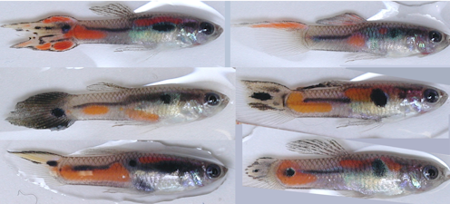 A male guppy looks good when he looks different.Mitchel Daniel, CC BY-ND
If you’re looking for love, it pays to stand out from the crowd. Or at least that’s how it works in some parts of the animal kingdom. Scientists have found that in several species – green swordtail fish, Trinidadian guppies, fruit flies, Poecilia parae fish...
Read more: Boredom in the mating market: Guppies demonstrate why it’s good to stand out